Copper mining experts​

About Us

OUR MISSION

Offer integral solutions to shareholders, customers, employees and the communities where we operate through the development of sustainable copper mining operations with high quality ,safety and environmental commitment standards

OUR VISION

Become the main producer and exporter of copper in Colombia by 2026 and lead the Latin American market before 2030 through short -term investments, strategic alliances and the maximization of return on investment
$10M
USD
Investment to date
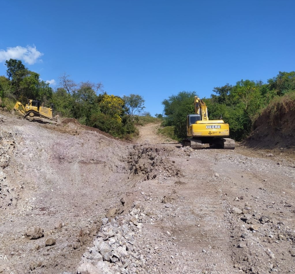
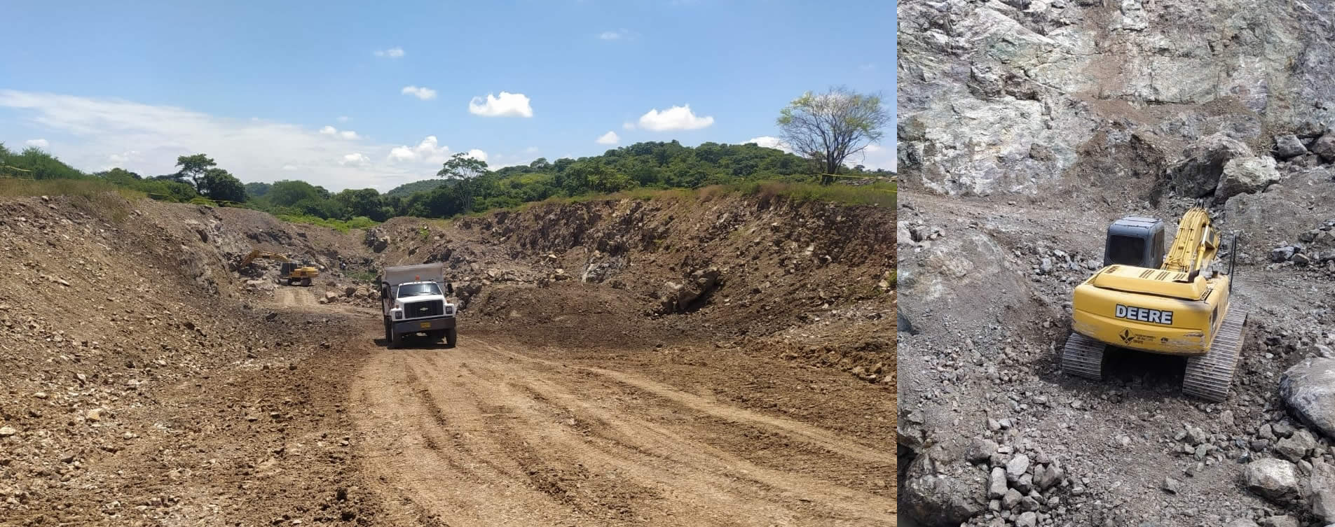
It was invested in setting up a benefit
plant, and mining development.

The Mining Project

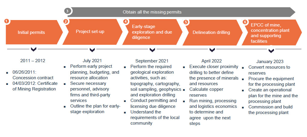
Currently, the mining project is in an early stage exploration phase since July 2021 . The mine is expected to start operating in January 2024.

The mine is located close to two important seaports in the Caribbean cost of Colombia

(Barranquilla and Santa Marta)

The mine is 180 kilometers away from the Santa Marta Seaport (3.25 hours by road) and 220 kilometers away from the Barranquilla Seaport (3.51 hours by road)

General overview

Cyprus Ore is a Florida LLC that controls the mining rights and the land containing a copper deposit in the north of Colombia.

Operational Plan
Characteristics of the mine location

Mine’s Location within Colombia
Overview
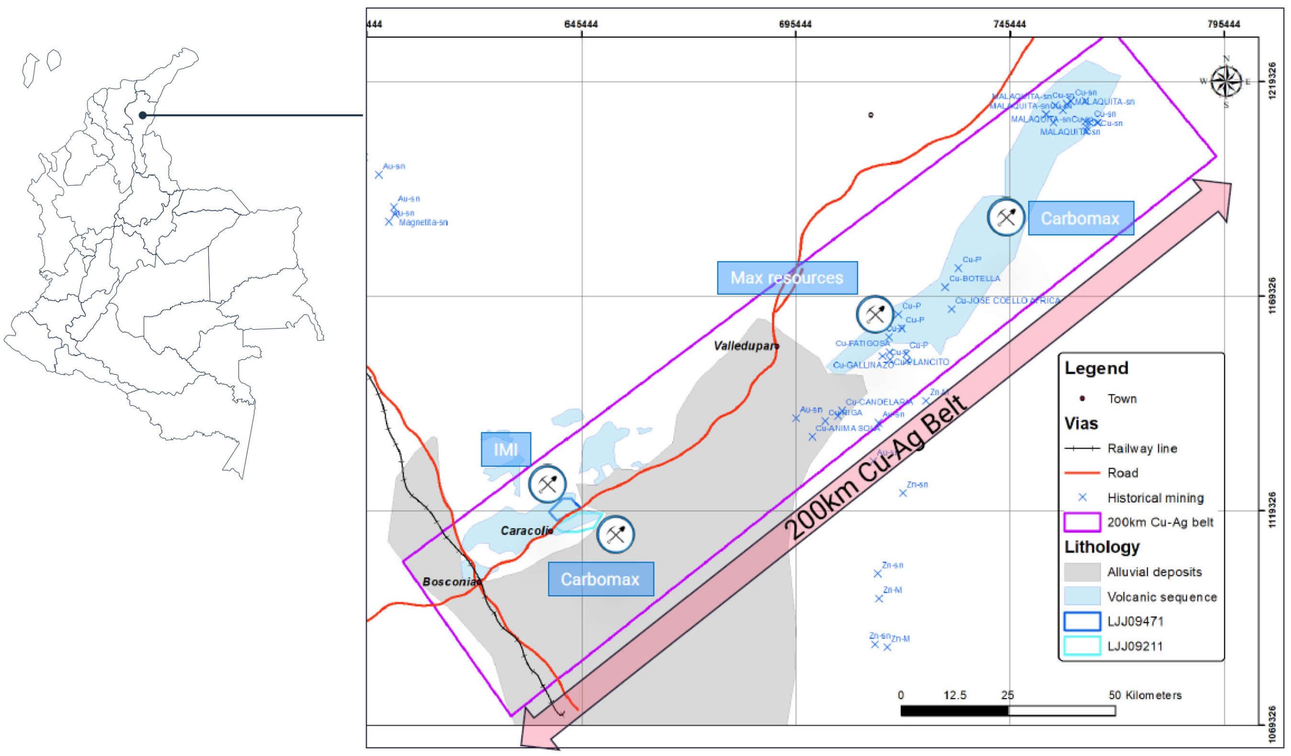
  • The mine is located in the region of Cesar, in the northeast of Colombia, 2 kilometers away from the town of Caracolí. The mine is accessible from Caracolí through a paved road.
  • Caracolí in the eastern valley of the Cesar River, about 70 kilometers away from Valledupar, an important city in the north of Colombia with a population of 500,000+. Major national toll roads connect the region with other large cities in the Caribbean cost like Barranquilla, Cartagena and Santa Marta.
  • The mine is ~25 kilometers away from a railroad used to transport coal to the Santa Marta Seaport.

Operational Plan
Mine’s location

The mine is 180 kilometers from the Santa Marta Seaport (3.25 hours by road)

The mine is 220 kilometers from the Barranquilla Seaport (3.51 hours by road)
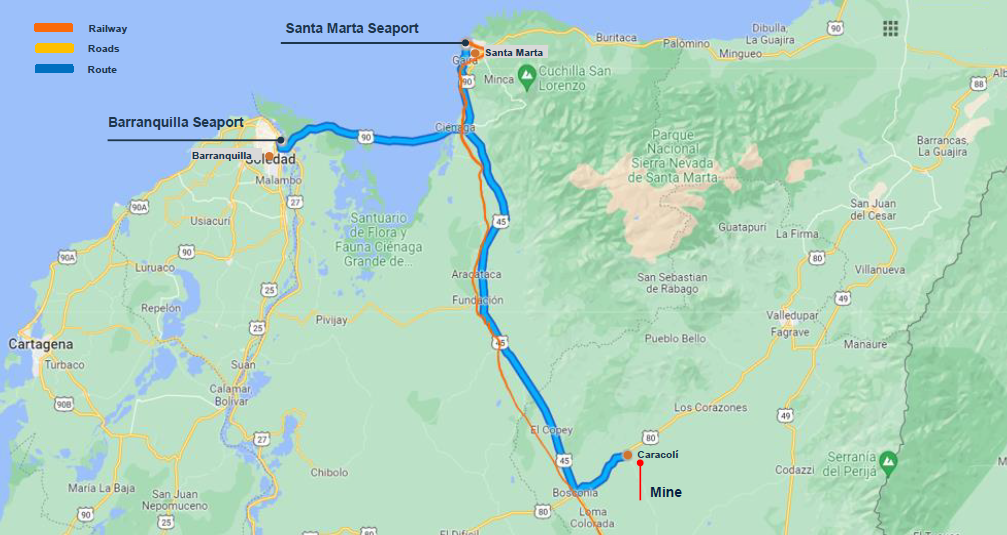
Source Google Maps 2022

Copper concentrate will be transported by land on trucks to the seaports

Operational Plan
Timeline to begin operations

The mine is expected to start operating in January 2024

Mining Exploration Overview
Exploring an undeveloped copper district in the north of Colombia

Outcropping copper silver stratabound core deposit

  • The regional position of the copper project is geologically consistent with the Triassic-Jurassic volcanic sequence Cu-Ag belt, of approximately 200km in scale, between Cesar and Guajira Departments.
  • Mining properties exhibit well-preserved secondary copper oxides in the first 3-5m of surface, and copper sulfides and sulfosalts with silver at >5m depth.


Multiple copper projects are transitioning into development in the area of influence

  • Carbomax
  • Max resource


Significant values of elements identified on rock (on site)

V 1.85%, Zn 0.46%, Ti 1.53%, Cu 25 40% and Ag 700 gr/t


Similar stratabound deposits are found in South America

Chile: Mantos Blancos Cu Ag 500 Mt @ 1% Cu, El soldado >200 Mt @ 1.4% Cu, Michilla district 66.7 Mt @ 1.57% Cu, Cerro Negro district 6 Mt @ 2% Cu 31 g/t Ag.
Peru: Tambogrande , Leonila Graciela, Raul Condestable , Cercapuquio and Yauli

Next steps of mining exploration (as of June 16th)

  • Finalize Drilling RFP and define the program’s extension
  • Build the Core shed
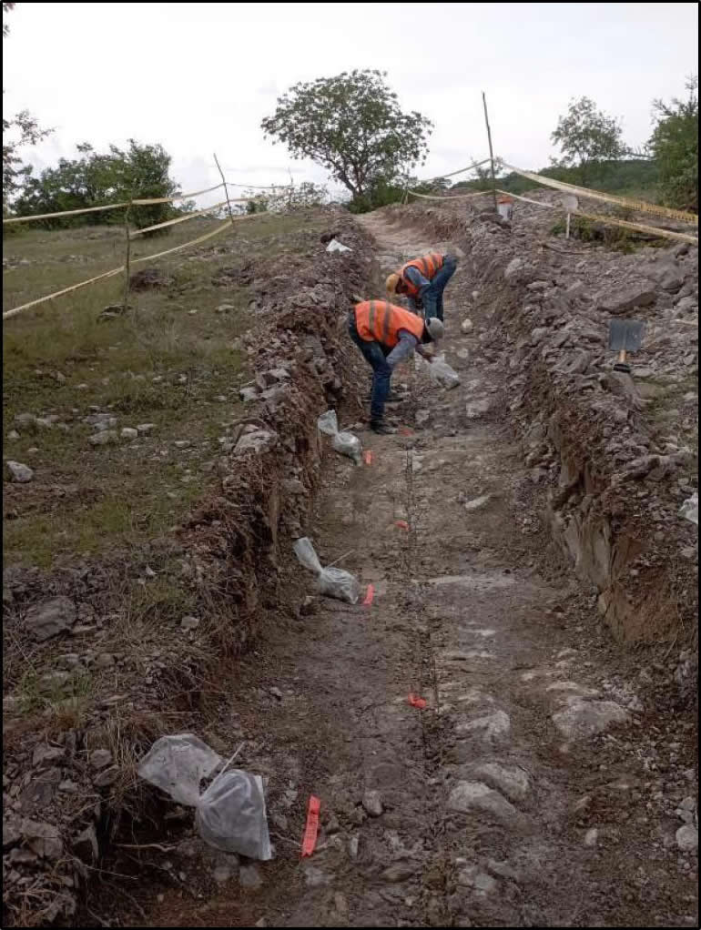
  • Focus on execution: i ) Finish soil campaign; ii) Finish trenches; iii) Start geophysics and; iv) Position the drill holes

Mining Exploration Overview
Copper district

Mining Exploration Overview
Sampling & cartography advance

The initial cartography advance is fully completed
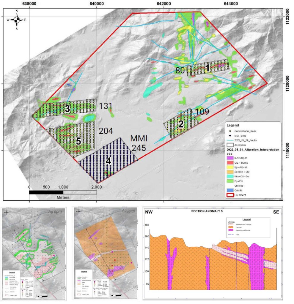
Total amount: 769 samples.
Grid: 50 x 100m. Sampling cartography is
divided in 5 main areas (anomalies):

Anomaly 1
Extension 1.2 km x 0.3 km, sampling plan
of 80 soils samples.

Anomaly 2
Extension 1 km x 0.5 km, sampling plan
of 109 soils sampling.

Anomaly 3
Extension of 1.7km x 0.35 km, sampling
plan of 131 soils samples.

Anomaly 4
Extension of 1,4km x 0.8km, sampling
plan of 245 soils sampling.

Anomaly 5
Extension of 1,2km x 0.6km, sampling
plan of 204 soils sampling.
Mining Exploration Overview
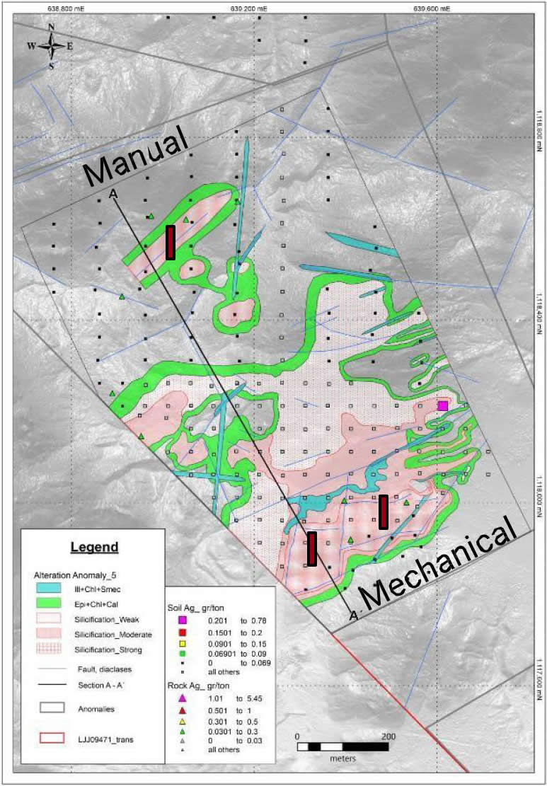
Trench program

Three exploratory trenches were defined in the Anomaly 05, in a prospecting corridor with the follow characteristics:

  • Hydrothermal breccias mapped on surface.
  • Anomalous values of gold and silver.
  • Moderate to high density of quartz + barite veins.
  • Broad hydrothermal alterations distinguished in an area of 300 x 200 m.

Cartography & rock sampling results continue to show a prospective corridor

Contact Us

    Your Name (required)

    Your Email (required)

    Your Phone Number (required)

    Your Message


    Close Search Window